Trump Landslide: Electoral Votes Map
Article date:
11 November 2016
Article category:
National News
Medium
Article Body:
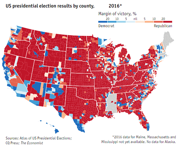
State and county voting map for the 2016 election (as of November 11, 2016):

The above map is available as an interactive map showing US presidential election results by county, 1952-2016 - see the article A country divided by counties, The Economist, November 11, 2016.
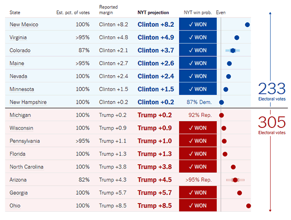
Key states in the 2016 election (as of November 10, 2016):

The above chart is from the New York Times - see the article Live Presidential Forecast, New York Times.
